Severe Storms, Flash Flooding Possible Through Saturday
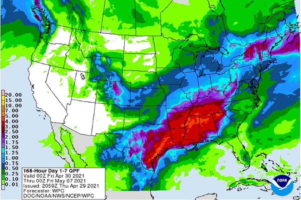
The National Weather Service is forecasting that Deep East Texas will have it's fair share of rain chances through next Wednesday. However, it's from late Thursday through Saturday night that the Pineywoods could experience heavy downpours and strong to severe storms.
Some of these cloudbursts could train over the same area over the course of a short period of time bringing the threat of localized flash flooding. Anywhere from an inch to nearly five inches of rain is expected across our area. Some of the storms in East Texas Thursday night and through a portion of the day Friday could reach severe limits. Then again Saturday, a few more strong to severe storms could develop across the Pineywoods. Hail and strong straight line winds will be the biggest threats from these storms (along with the possibility of flash flooding), but a stray tornado is not out of the question.
As of late Thursday night, rainfall amounts of about an inch or two have already fallen across parts of northern Houston, southern Anderson and southern Cherokee Counties. Shower and storm activity is expected to increase throughout the night on Thursday. Cooler temperatures are expected across the area on Friday before a gradual warming trend takes hold through the weekend. Highs near 90 are expected by mid-week next week.
Rain chances will continue off and on from next Monday through Wednesday, but as of this time, no severe weather nor flooding is expected. But, this is Springtime in East Texas, so always be aware of rapidly changing weather conditions. Make sure you've downloaded the free KICKS 105 App to have weather alerts sent to your smartphone.

LOOK: The most expensive weather and climate disasters in recent decades
More From Newstalk 860


