Lufkin, Nacogdoches in Bull’s-Eye of Damaging Severe Storms
Alright, East Texas, you know the routine. Whenever we see above-normal temperatures during Winter, it's just a matter of time before a cold front moves into the area kicking off a round of strong to severe storms. That time is now...as in today (Wednesday, January 19).
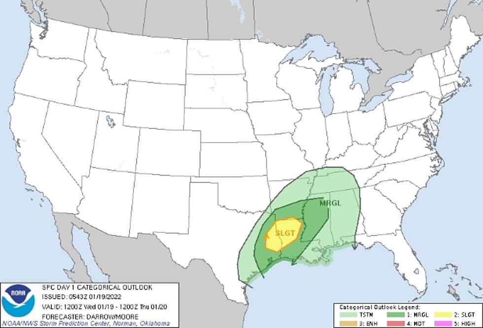
A strong cold will be making its way across East Texas later this afternoon bringing with it the potential for severe storms. The Storm Prediction Center in Norman, Oklahoma is forecasting the possibility of severe storms in a swath from East Texas through Louisiana and into western Mississippi and southern Arkansas. However, there is an area from Deep East Texas through northern Louisiana that they have marked for the highest potential of severe weather.

What Kind of Severe Weather?
The biggest threat from these severe storms will be damaging winds associated with thunderstorms. These gusts could top 60 mph in some cells. There is also the possibility of hail up to a half-dollar in size. As far as tornadoes go, the threat is low, but unfortunately, a pop-up tornado cannot be ruled out.
What's the timing?
Slight rain chances are already here, however, the chance for strong to severe storms will come in the afternoon to evening hours. The National Weather Service is indicating that the best chances for nasty weather across the Pineywoods will take place between 2 p.m. and 9 p.m. We will still reach a high today in the 70s, but expect the cooler weather to start filtering in late this afternoon.

Download our free KICKS 105 App to keep up with the changing weather and to have breaking weather alerts sent to your smartphone.
Gorgeous Home in Montgomery, Texas For Sale
More From Newstalk 860