Damage Reported in Lufkin as Storms Plow Through East Texas
City of Lufkin emergency personnel are getting numerous damage reports from the line of strong storms that blew through the area around 9:30 this morning. The National Weather Service in Shreveport cannot confirm a tornado, however City of Lufkin dispatchers have received reports of a funnel passing over Lufkin City Hall that moved over to the Timberland Drive area.
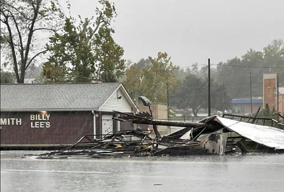
Some of the observed damage includes a billboard down in the road by Billy Lee’s Locksmith at 500 E. Frank Ave. and debris scattered through roadways around the city. There is a also tree across Leon Street at Paul Avenue. There are numerous reports of power outages across the city as well with lines down.
If you see a line down DO NOT APPROACH IT. Call the City of Lufkin non-emergency number at 936-633-0356 so that the situation can be reported to Oncor.
A tornado watch remains in effect until 4 pm for Angelina, San Augustine, Sabine, Shelby, Jasper and Newton Counties. The watched has now been dropped as of 10 am for Polk and Trinity Counties as the cold front has passed through those counties taking away the threat of severe weather. The tornado watch for Angelina County should be dropped shortly as well.
At 10:30 am, a well-defined line of strong storms extends from near Center to San Augustine to west of Jasper. Those areas between Lake Sam Rayburn and Toledo Bend should remain alert for the possibility of severe weather, especially in the form of damaging winds.
Clearing skies are expected later this afternoon with overnight lows in the 50s. Beautiful Fall-like weather is expected through the Halloween weekend.
Strom Damage Lufkin
More From Newstalk 860